Important Web Links: City of Gardner Safety Action Plan page, CLICK HERE. —- Interactive Map, CLICK HERE.
Gardner MA Vision Zero Safety Plan Interview
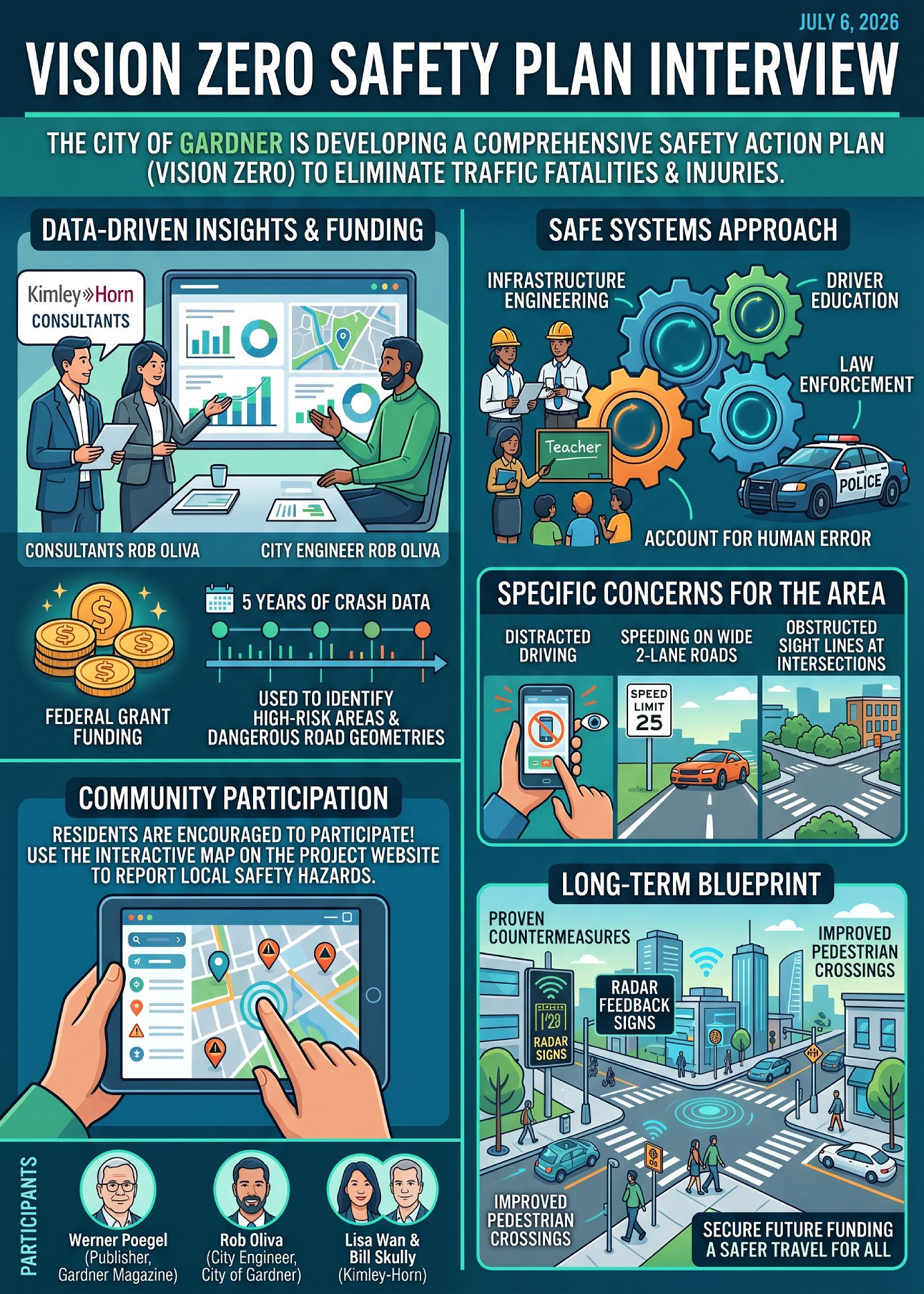
It’s all about eliminating traffic fatalities and injuries with the goal of reducing the numbers to zero. Gardner Magazine had the honor of speaking with Lisa wan and Bill Skully of Kimley Horn along with City of Gardner Engineer Rob Oliva on July 6, 2026. Listen to the interview on any device, CLICK PLAY.
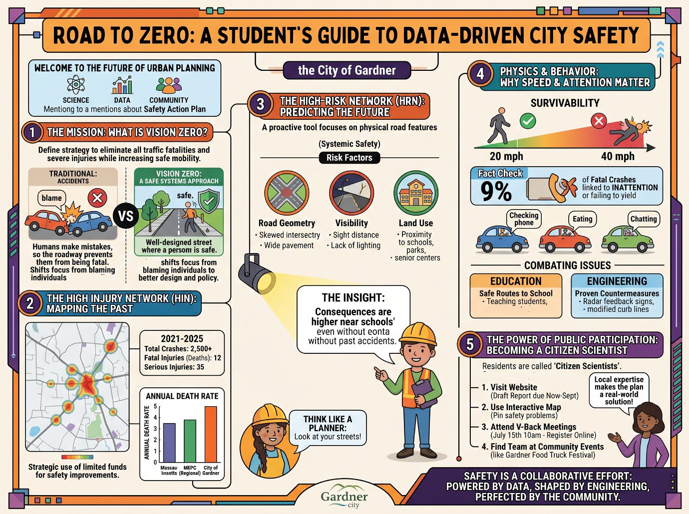
The City of Gardner has initiated a comprehensive Safety Action Plan, often referred to as a “Vision Zero” plan, aimed at eliminating all traffic-related fatalities and serious injuries on its roadways.
Supported by a federal grant from the U.S. Department of Transportation’s “Safe Streets and Roads for All” (SS4A) program, the initiative is a 12-month project that transitions from data analysis to long-term implementation.
Analysis reveals that Gardner faces significant safety challenges, with fatality rates exceeding both regional and state averages. The plan utilizes a “Safe Systems Approach,” which acknowledges that human error is inevitable and seeks to minimize the severity of crashes through a combination of roadway engineering, law enforcement, and public education. Key deliverables include the identification of a High Injury Network (HIN) and the recommendation of “proven countermeasures” to be funded through state and federal sources over the coming decades.
Overview of the Vision Zero Initiative
The primary mission of the Gardner Safety Action Plan is to establish a blueprint for roadway safety that prioritizes human life.
- Federal Funding: The project is funded through the federal SS4A program, which provides the resources necessary to develop the plan and subsequently apply for implementation grants.
- The Goal: The “Vision Zero” philosophy is centered on the target of zero traffic-related deaths and serious injuries.
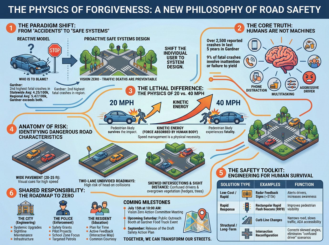
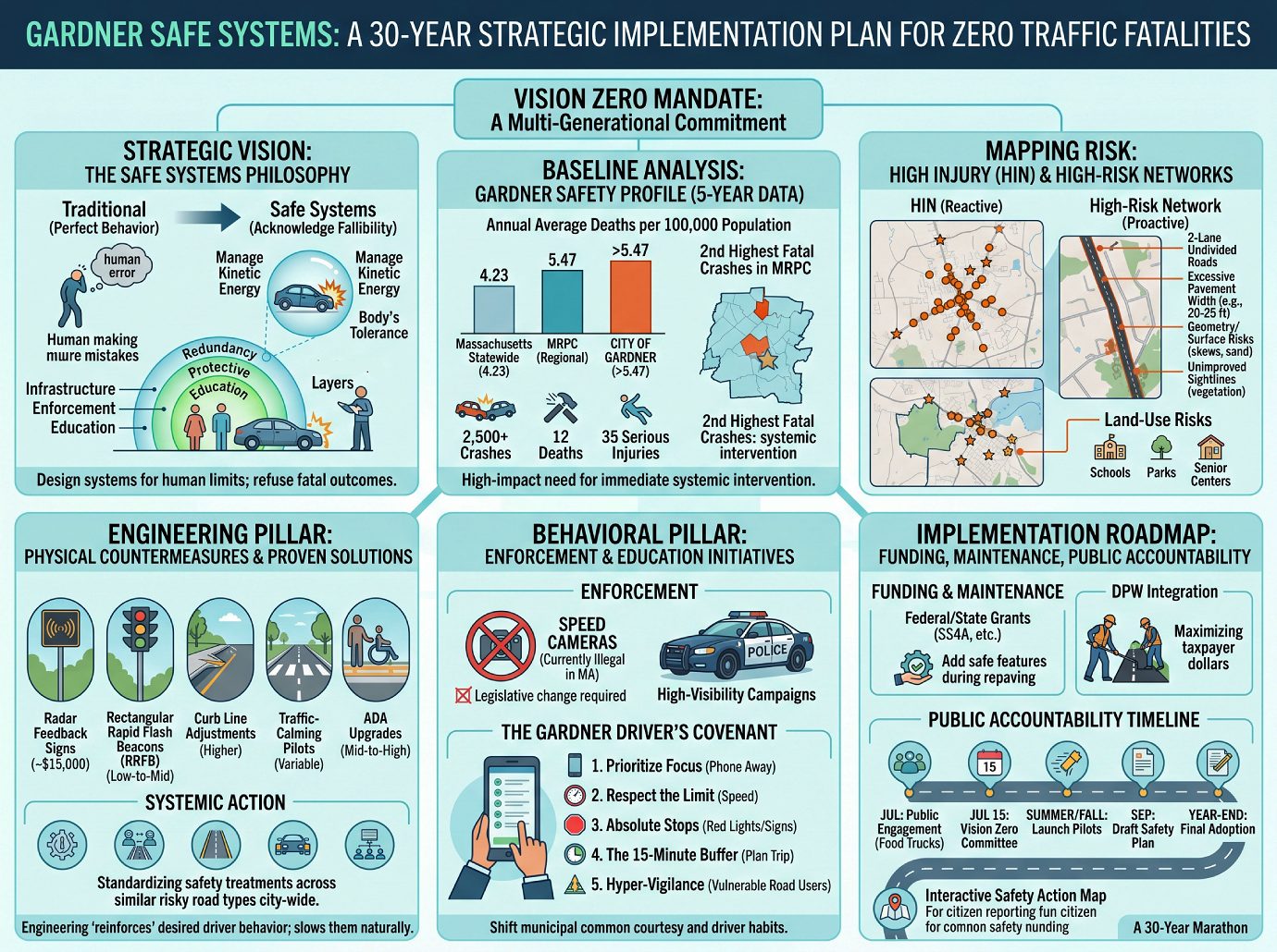
- Safe Systems Approach: This framework shifts the focus from solely blaming driver behavior to designing a system that accounts for human mistakes. The goal is to ensure that when mistakes happen, they do not result in fatal or incapacitating outcomes.
Current Safety Landscape in Gardner
Data analysis provided by consultants from Kimley-Horn and regional planning commissions indicates that Gardner’s roads require significant safety interventions.
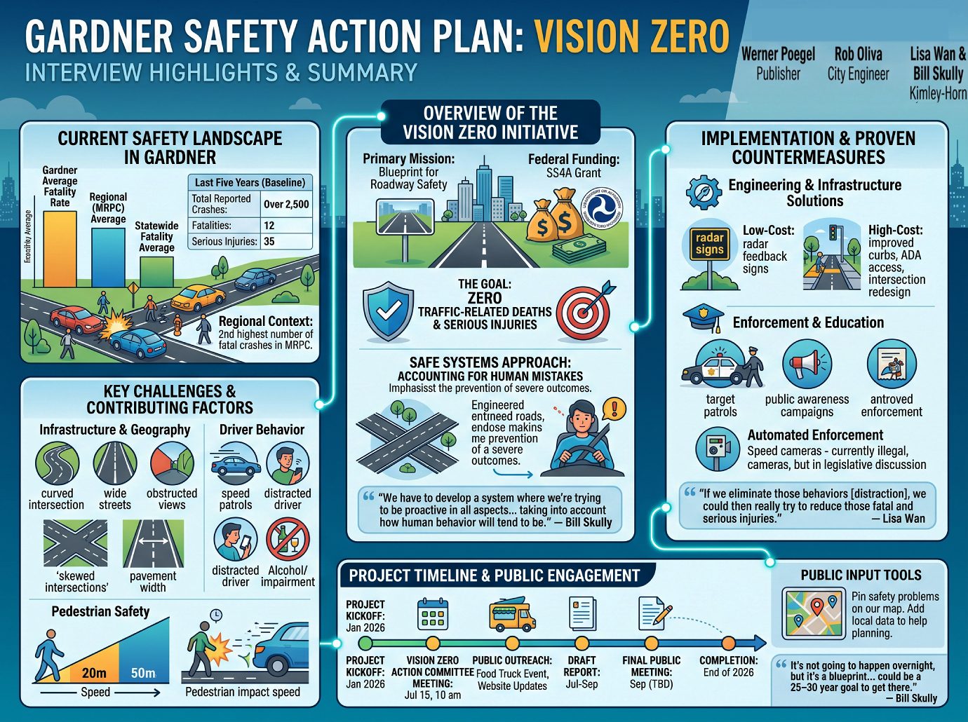
Statistical Baseline (Last Five Years)
The study examines a complete five-year data set to establish a baseline for safety improvements.
| Metric | Data Point |
|---|---|
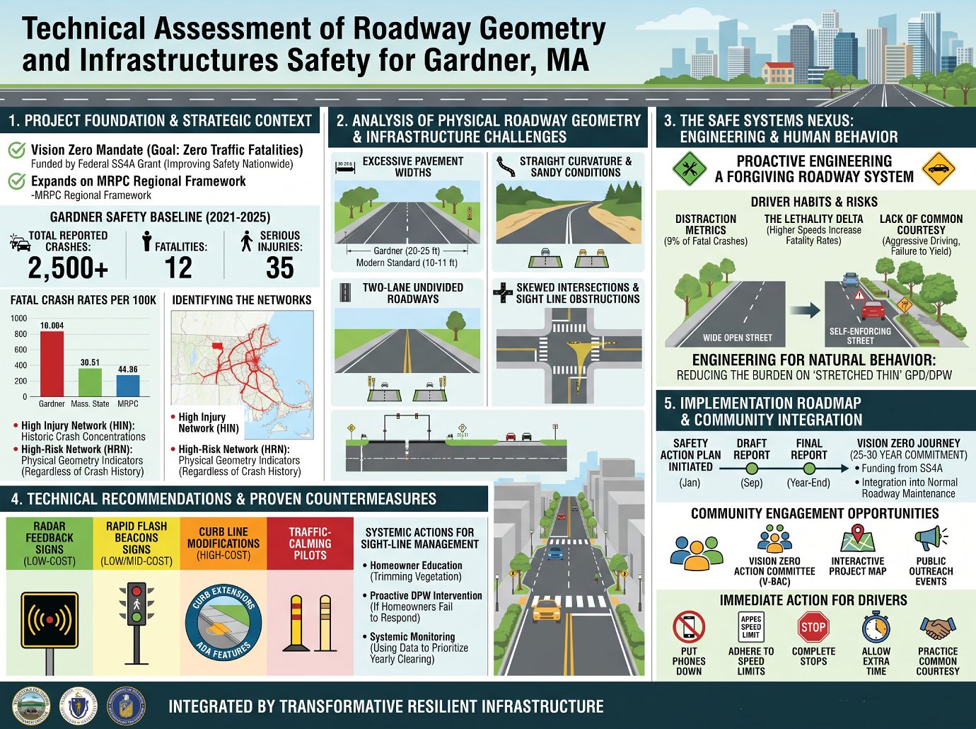
| Total Reported Crashes | Over 2,500 |
| Fatalities | 12 |
| Serious Injuries | 35 |
| Statewide Fatality Average | 4.23 per 100,000 population |
| Regional (MRPC) Average | 5.47 per 100,000 population |
| Gardner Average | Exceeds both State and Regional averages |
Regional Context: In comparison to the Montachusett Regional Planning Commission (MRPC) region, Gardner has recorded the second-highest number of fatal injury crashes, surpassed only by Leominster.
Key Challenges and Contributing Factors: The safety issues in Gardner are a product of both physical infrastructure and human behavior.
Infrastructure and Geography
Consultants identified several physical characteristics of Gardner’s roadways that contribute to risk:
- Roadway Design: A prevalence of two-lane undivided roadways and “skewed” intersections with awkward geometry that may no longer suit modern traffic flow.
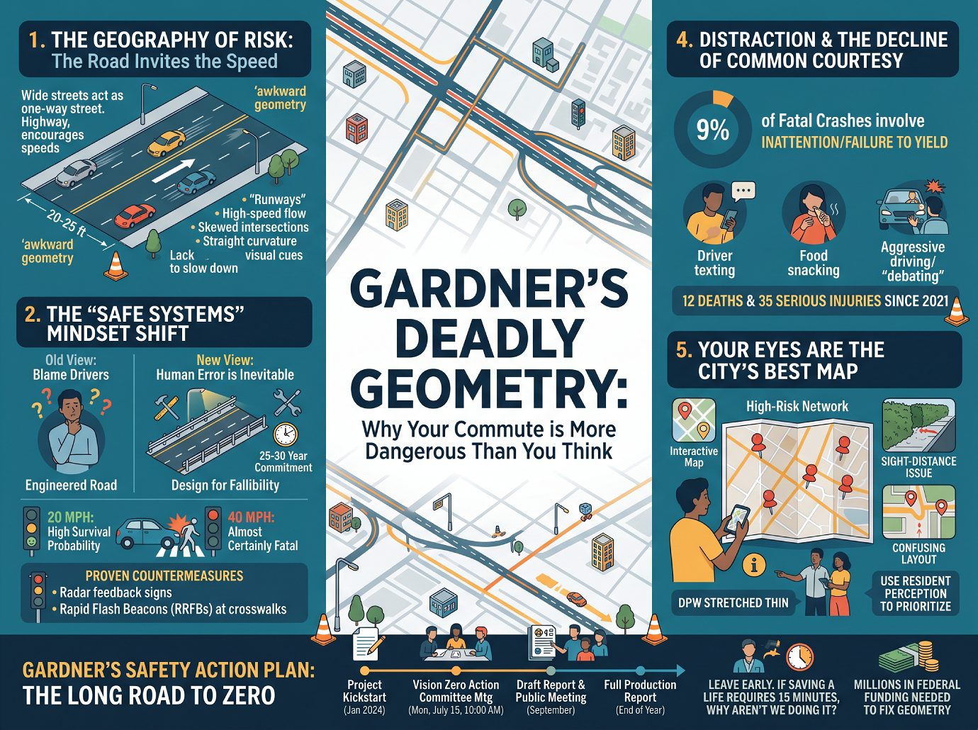
- Pavement Width: Many one-way and residential streets are excessively wide (20 to 25 feet), which can inadvertently encourage higher speeds.
- Sight Distance Obstructions: Issues with visibility at side streets entering main roads, often exacerbated by overgrown vegetation or hedges on private property.
Behavioral factors remain a significant concern in fatal and serious injury incidents:
- Distraction and Inattention: Approximately 9% of fatal crashes involve inattention or failure to yield.
- Speeding: Speed is cited as the most significant factor in the severity of injuries. A pedestrian hit at 20 mph likely survives, while the opposite is true at 40 mph.
- Impairment: While data on marijuana and alcohol impairment is tracked, current recorded numbers may be lower than reality due to reporting complexities.
- Lack of Courtesy: Observations suggest a decline in “common courtesy” and adherence to basic rules, such as right-of-way at four-way stops.
Implementation and Proven Countermeasures
The plan will move from identifying the High Injury Network (areas with a history of crashes) and the High-Risk Network (areas with dangerous characteristics) to recommending specific “proven countermeasures.”
Engineering and Infrastructure Solutions
- Low-Cost Items: Installation of radar feedback signs (approx. $15,000 per unit) to alert drivers of their speed.
- High-Cost Items: Changing curb lines, improving ADA accessibility, and redesigning intersections to separate pedestrians and cyclists from motor traffic.
- Systemic Actions: Applying similar treatments to roadways that share characteristics with high-injury areas to prevent future incidents.
Enforcement and Education
- Targeted Patrols: The Gardner Police Department utilizes Municipal Road Safety Grants to run monthly campaigns focused on specific issues like pedestrian safety.
- Automated Enforcement: While currently illegal in Massachusetts, the plan acknowledges ongoing legislative discussions regarding the potential future use of speed cameras in school zones.
- Public Awareness: Educational efforts targeting various demographics, including safe routes to school for children and driving safety workshops for seniors.
Project Timeline and Public Engagement
The Safety Action Plan is a 12-month production process that relies heavily on community input.
Key Dates
- Project Kickoff: January 2026.
- Vision Zero Action Committee Meeting: Wednesday, July 15th at 10:00 a.m. (Multidisciplinary group including city staff, business owners, and regional planners).
- Public Outreach: Participation in the Gardner Food Truck event and ongoing updates via the project website.
- Draft Report: Expected between July and September.
- Final Public Meeting: September (Date TBD).
- Completion: Full report production finalized by the end of 2026.
Public Input Tools
Residents are encouraged to use the interactive map on the Gardner Safety Action Plan website. This tool allows citizens to pinpoint specific locations where they perceive safety problems, providing the planning team with localized data that automated crash reports may miss.
Notable Insights and Quotes
“The goal is eliminate those zero traffic-related deaths and serious injuries on the roadways… Gardner is actually really special because we are expanding the comprehensive regional safety action plan.” — Lisa Wan, Transportation Engineer
“We have to develop a system where we’re trying to be proactive in all aspects and take into account how human behavior will tend to be. You know, they want to drive fast. They’re not paying attention, distracted driving… there are going to be mistakes happening.” — Bill Skully, Kimley-Horn
“If we eliminate those behaviors [distraction], we could then really try to reduce those fatal and serious injuries.” — Lisa Wan, Transportation Engineer
“It’s not going to happen overnight, but you know, it’s a blueprint to keep working towards… it could be a 25–30 year goal to get there.” — Bill Skully, Kimley-Horn
Additional Infographics for your review: CLICK IMAGE for larger view
Vision Zero – A Road to Safety – Infographics on this important issue.
CLICK any Image for larger view
Important Web Links: City of Gardner Safety Action Plan page, CLICK HERE. —- Interactive Map, CLICK HERE.