Editorial – Clarity Needed for Future
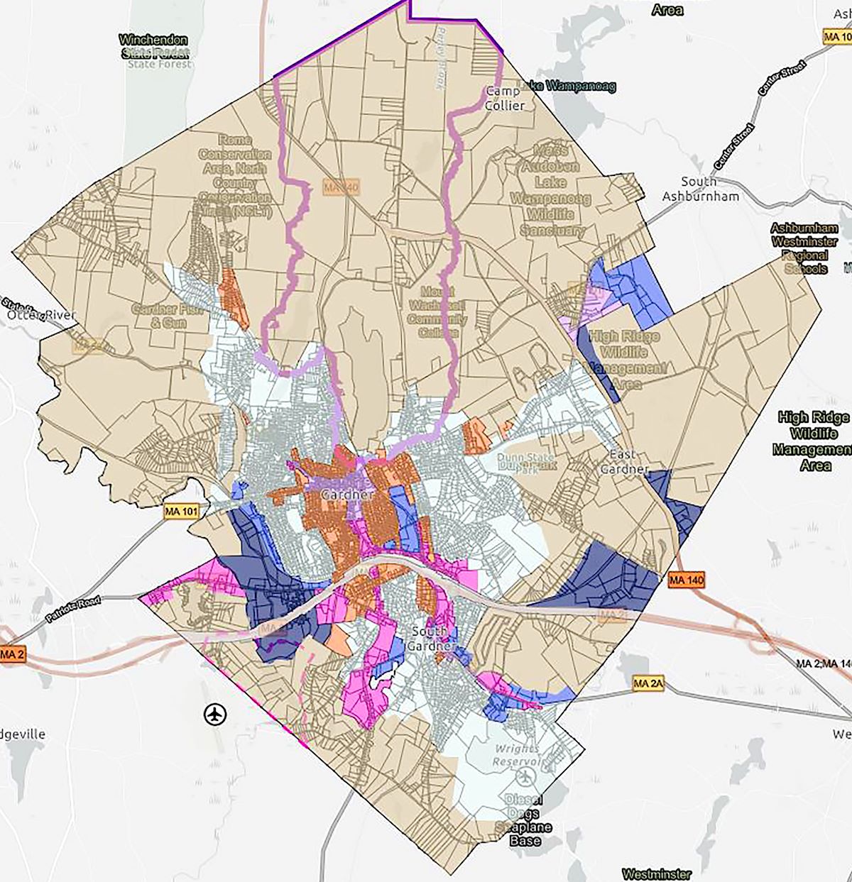
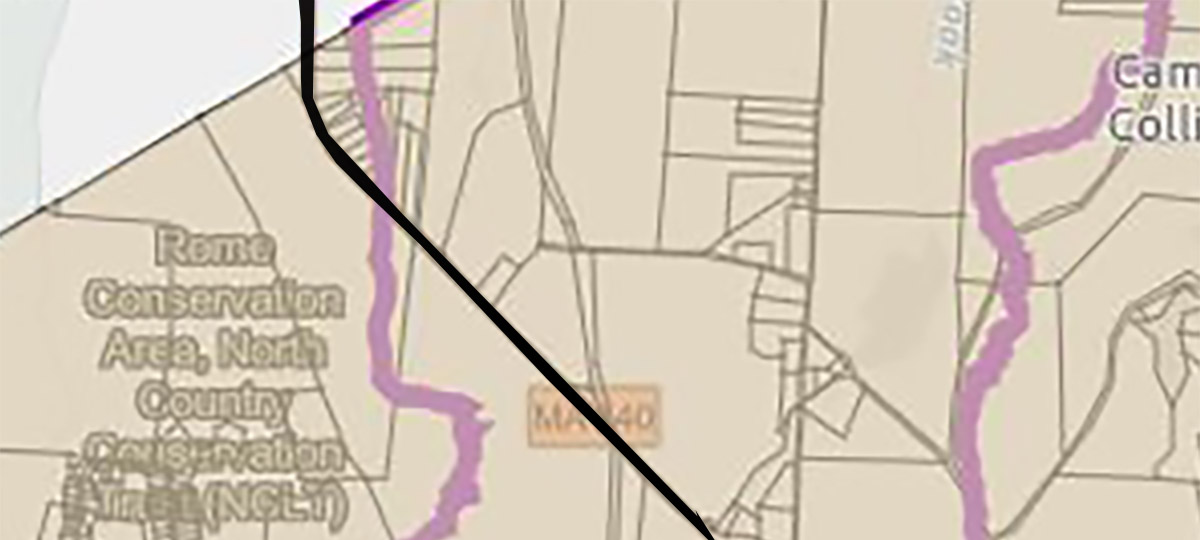
With the recent debate over Route 140 Zoning on 2 parcels, there is some ambiguity left as to other parcels. We suggest a careful inspection of every parcel as to “Open Space” protection . For example, we just pulled up this map from the City of Gardner database. The purple line is around the water protection area. You’ll notice some areas not within the line are claimed to be protected. That may very well be why the original proposal was made with the honest belief the land could be used as commercial even though others thought differently. Solution now is update official records accurately after researching data. Review all parcels in City as to intended use and document for benefit of future generations.
The Mayor is right. Councilor Dana Heath and other Councilors are right. Gardner needs more business to help lower taxes for its residents. It needs to make the best use of its existing buildings. The current Mayor has helped to bring in business and get blighted properties back on the tax rolls. And the citizens are right. Land needs to be examined and used for the highest, best use. In some cases, that would be a new commercial business. In other cases, that may be nothing but open space with a view to the sky. We are so fortunate the City of Gardner has room for both visions.
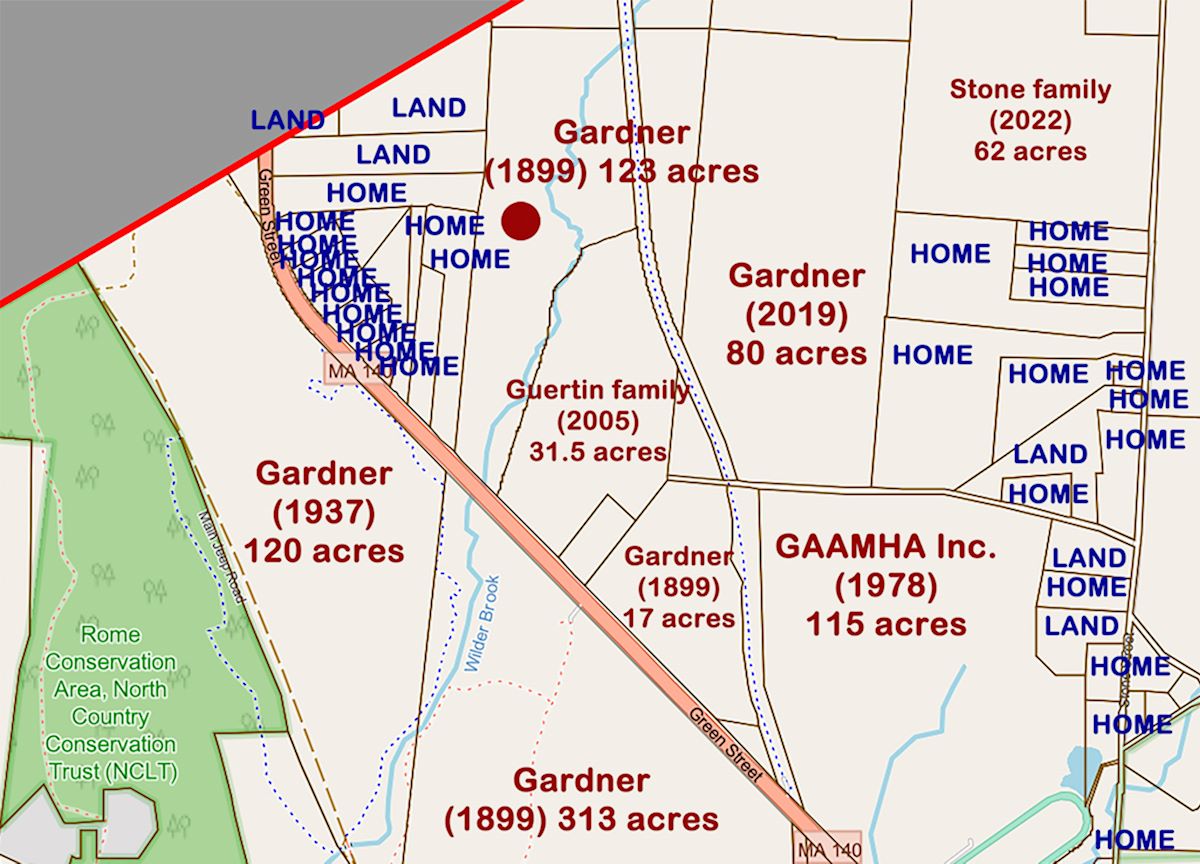
Who owns What in Route 140 area? (Near Winchendon line) – City owns 653 acres – GAAMHA Inc. owns 115 acres – Private Homes are marked as HOME and small parcels of vacant land are marked as LAND. The online Map database can be explored. CLICK HERE.