


FEMA has an interactive Flood Map website. As of the date of this article, the online maps still show a date of July 2, 1981, but there are some notations of modifications since then. Simply put in your location and you can easily find your home’s status, CLICK HERE. —- There is also a very useful FAQ on the FEMA website. — There is also a new online location comparing the map changes, CLICK HERE.
For example, the current flood map for the location of Gardner City Hall can be found here.
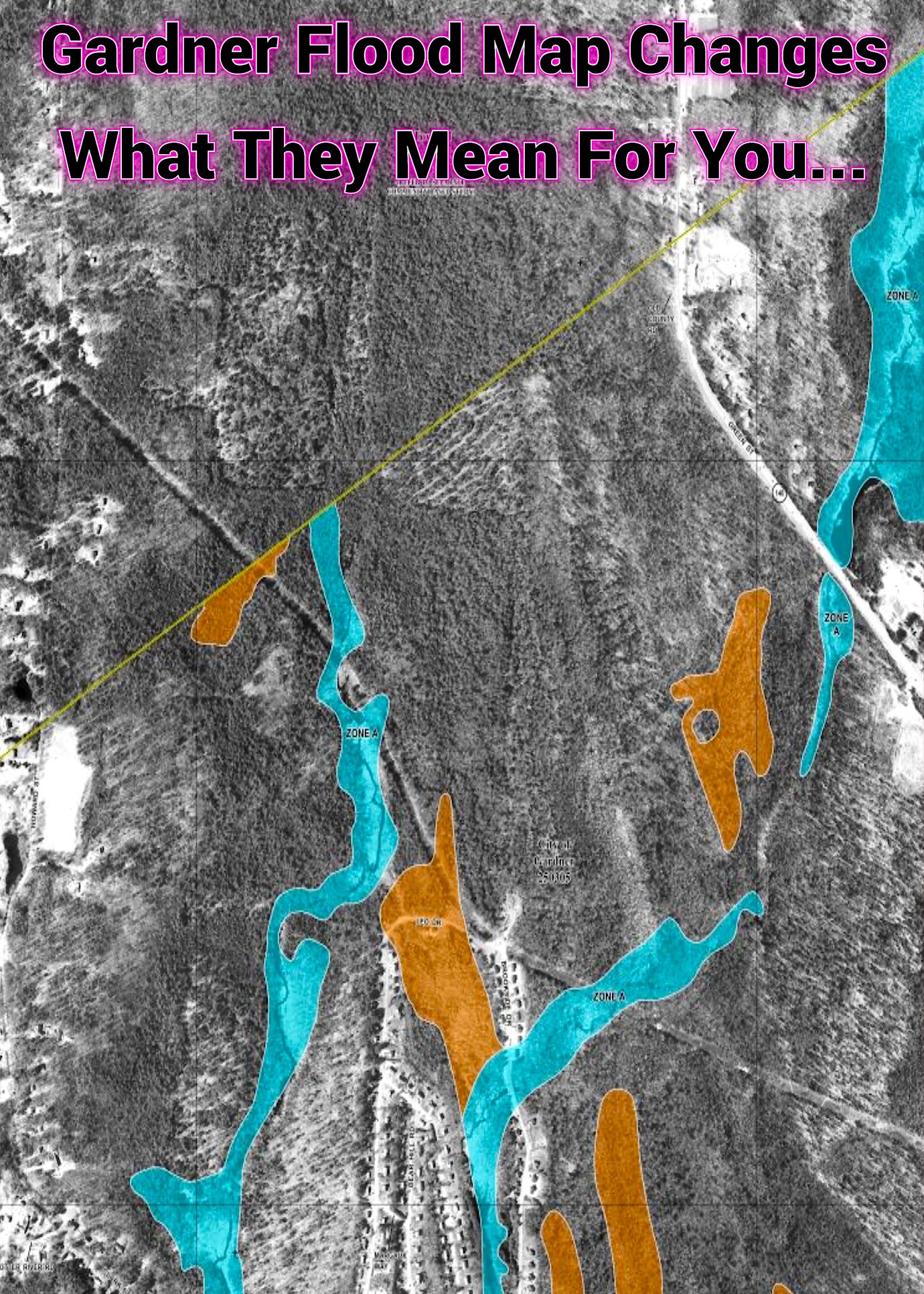
Gardner Flood Maps Change In July – Complete Information
The City of Gardner is informing residents that FEMA has published updated Flood Insurance Rate Maps that will become effective July 8, 2025. According to the City, these maps are based on updated flood studies and are easier to read and interpret than the previous maps. There are various resource links below so you can get more information. Gardner Magazine has prepared a “Deep Dive” podcast which explains it all. Listen on any device, CLICK PLAY.
Here is the information page from the City of Gardner with download links for all of the maps and individual map panels, CLICK HERE.
Two things can happen if there’s a change in the status of your property when maps change. 1. For some homeowners, a flood insurance policy may no longer be required. However, it may be prudent to continue a policy as FEMA notes that up to 40% of flood damage occurs outside of the mandatory flood insurance zone. 2. Some homeowners may now be required to obtain flood insurance. However, Gardner residents facing a flood insurance payment increase may be eligible for a discount the first year and any premium increases may be capped at 18% annually.